GREAT WALK · AOTEAROA
Routeburn Track
About 33 km over two or three days, with one big day above the bushline. What it asks of your legs, and how to train for it.
Fiordland & Mount Aspiring
Explore this trek
Plan the route
Routeburn Track at a glance
- Distance
- 33 km
- Time on trail
- 2–3 days
- Highest point
- 1,255 m
- Best season
- Nov – Apr
- Route type
- Alpine Track
- Where you stay
- Hut-based
Times, conditions and route variants can change. Check current local guidance before you set your itinerary.
OVERVIEW
GREAT WALK · AOTEAROA
Train with Peaksted
Arrive ready for Routeburn Track.
Check where you stand against what this trek demands, then choose the level of support that fits your timeline.
ROUTE PROFILE
DISTANCE
33 km
HIGHEST POINT
1,255 m
OBJECTIVE DEMAND PROFILE
What This Trek Demands
This is what the objective itself demands — not a reflection of your current fitness.
What to Expect
Terrain
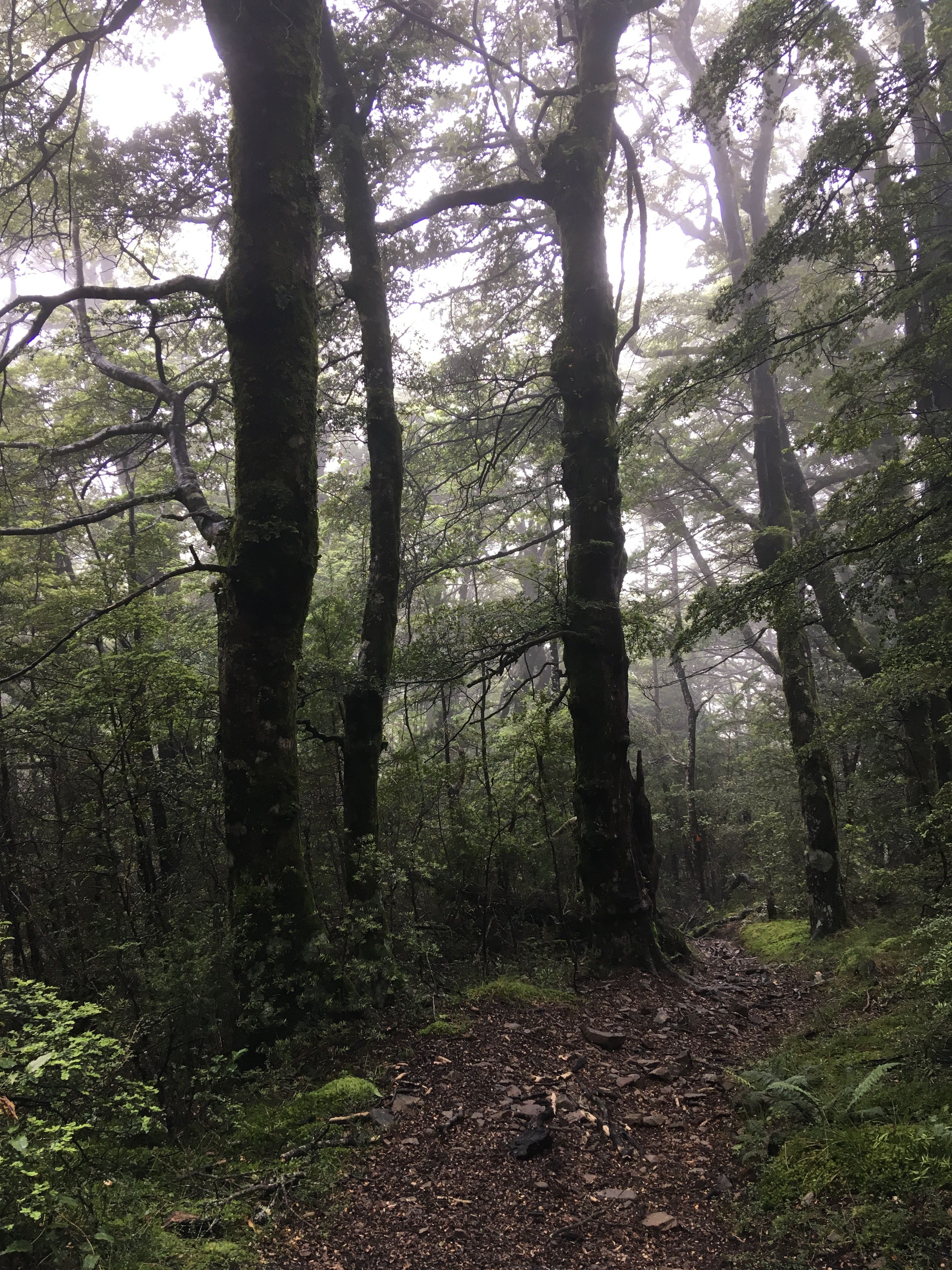
Well-graded track with sections of roots, rocky steps and exposed alpine terrain above the bushline.
Accommodation
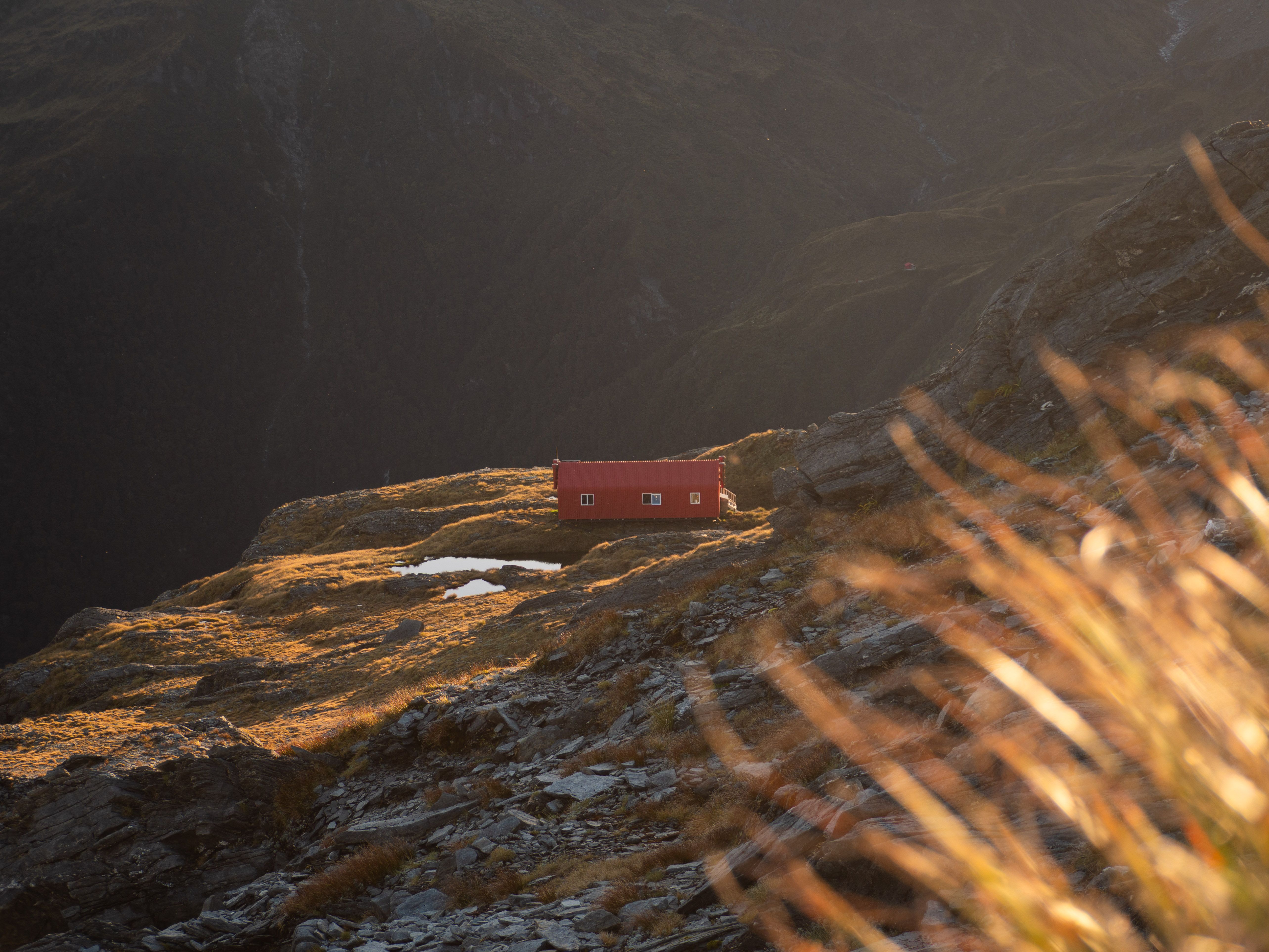
Great Walk huts and campsites along the route. Bookings essential in peak season.

Typical Day
A short first day of 2.5 to 4 hours, then the big one at 4.5 to 6 hours, then 4 to 5.5 hours down to The Divide.


Exposed tops
Harris Saddle and the tops beyond are fully exposed, and the weather can change fast.
The sustained climb
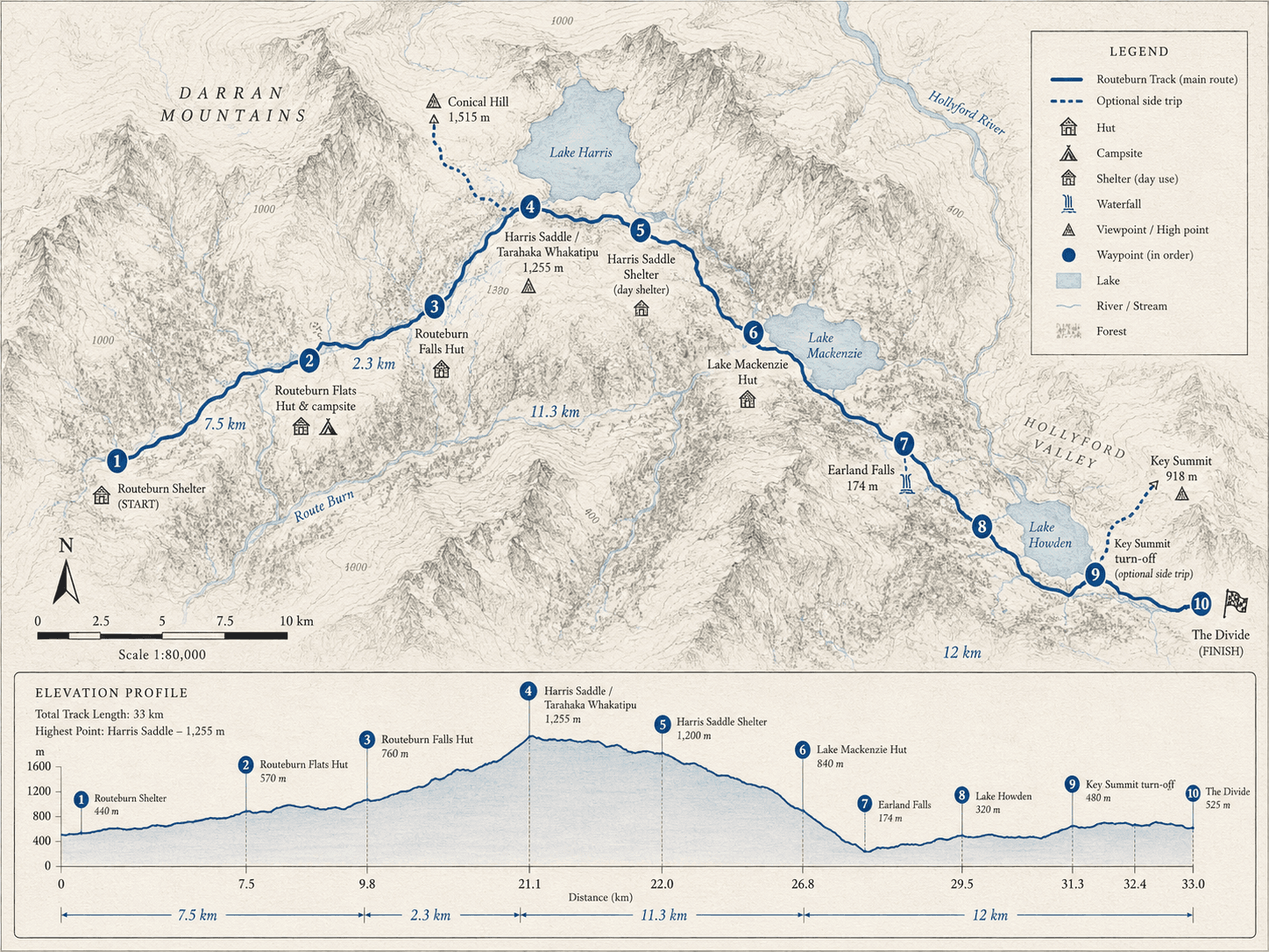
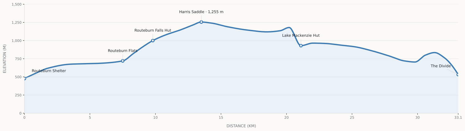
Day two climbs steadily above the bushline to 1,255 m, the biggest effort on the route.
A long way down
Day three is 12 km, mostly downhill, on legs that did the climb the day before.
How to Prepare
Three things make the biggest difference on the Routeburn.
1
Train the climb
Day two is a sustained climb above the bushline. Hills or stairs at a talking pace.
2
Get used to exposure
Layers, food and a plan for hours with no shelter past the saddle.
3
Practise day after day
Link a long walk with a second one the next morning.
4
Plan for rain
Flooding is common after heavy rain. Waterproofs, a dry bag and a flexible plan.
READINESS
How does your current capacity compare?
This objective places specific demands across seven physical capacities. Check your readiness to see how you compare, and where to focus before you go.
CHECK YOUR READINESS
PREPARE FOR THE TREK


Guide series
Prepare for the New Zealand Great Walks, one question at a time
Three short guides that build on each other. Each answers one question and links to the others instead of repeating them. Read them in order, or jump to what you need.
 1Part 1 · How hard · 8 minHow Hard Are the Great Walks?Which is easiest, which is hardest, and which should I pick?Read guide →
 2Part 2 · How fit · 6 minHow Fit Do You Need to Be?What do I train, and where do I start?Read guide →
 3Part 3 · How to train · 10 minHow to Train for the Great WalksWhat do I actually do each week?Read guide →
- 4Part 4 · The Milford · 6 minHow Hard Is the Milford Track?What does day three really ask, and how do I train for it?Read guide →
- 5Part 5 · Fiordland compared · 5 minMilford vs Routeburn vs KeplerWhich Fiordland walk, and what if the Milford is full?Read guide →
The Routeburn in numbers
Two to three days, one direction, one big day above the bushline. Here is what you are signing up for.
- 33 kmone way, end to end
- 11 to 15 hof walking, all in
- 3 daysis what most walkers take
- 1,255 mHarris Saddle, the high point
- 9,000 mmof rain a year at the wettest
- 325 kmby road between the two ends
Day by day
Routeburn Shelter to Routeburn Falls Hut
9.8 km · about 2.5 to 4 h
Forest, a swing bridge or two and a steady climb up the valley to the falls. A gentle start with the first real gradient at the end.
Routeburn Falls Hut to Lake Mackenzie Hut
11.3 km · about 4.5 to 6 h
Up above the bushline to Harris Saddle at 1,255 m, then a long traverse along the open tops and down to the lake. The one big day, and the one with no shelter.
Lake Mackenzie Hut to The Divide
12 km · about 4 to 5.5 h
Mostly downhill through forest, past Earland Falls, to the road end at The Divide. Pleasant, but it is a long way down on tired knees.
How to train for it
Practise the climb to the saddle
Day two is a sustained climb above the bushline. Hills, stairs or an incline, at a pace where you can still talk. Aerobic pacing
Build legs for the way down
Harris Saddle is followed by a long descent, and day three is more downhill. Slow step-downs, a few weeks out. Strength training for hikers
Get used to the open tops
The tops past the saddle have no shelter for hours. Practise eating and layering on the move. Mountain day field guide
Not sure where you stand? The free readiness check takes about three minutes and shows which of seven areas to work on first. Then pick how much help you want:
- I will do it myselfTrek ReadyAn eight-week self-guided programme to follow, if you already walk regularly and want structure.
- I want it built around my datesPersonalised planMatched to your departure date, what you can do now and the terrain you have nearby.
- I want someone in my corner1:1 coachingIndividual guidance and adjustments, useful if exposure or the climb makes you nervous.
Want the full picture first? Read how fit you need to be and the ten-week Great Walks training guide, or compare it with the other Great Walks. Food matters too: see what to eat before and after a hike and how much to eat and drink hour by hour.
Booking and getting there
- Season
- Great Walks season runs 1 November 2026 to 30 April 2027. In winter, snow and ice at Harris Saddle can be extremely dangerous.
- Booking
- Huts and campsites are booked through DOC in season, and popular dates sell out.
- Getting there
- The two ends are 325 km apart by road, so you need transport at each end. No phone coverage on the track.
- The huts
- Routeburn Flats, Routeburn Falls and Lake Mackenzie huts, plus campsites. Harris Saddle Shelter is day use only.
- Rain
- Fiordland gets up to 9,000 mm a year, and DOC notes flooding is common on sections after heavy rain.
- Side trips
- Key Summit is 1 to 1.5 hours return and Conical Hill 1.5 to 2 hours return. Both add time to a big day.
DOC: Routeburn Track · MetService mountain forecast · Other Fiordland walks: Milford, Kepler · Compare all three
Questions
How hard is the Routeburn Track?
Moderate overall. Day two climbs to Harris Saddle (1,255 m) and crosses open, exposed tops, which is the hard part. The other days are gentler. Most walkers take 3 days and 2 nights.
How long does the Routeburn Track take?
Most walkers take 3 days and 2 nights, staying at Routeburn Falls and Lake Mackenzie huts. It is about 33 km one way, with transport needed at each end.
How fit do you need to be for the Routeburn?
Comfortable walking four to six hours, climbing steadily and coming down with control. It is shorter than the Milford or Kepler, but the climb and exposure are real.
Routeburn or Milford?
The Routeburn is shorter and more alpine, with a bigger climb. The Milford is longer, gentler underfoot and its hard part is the descent on day three. Our Milford vs Routeburn vs Kepler guide compares them.
What if the weather turns?
The tops past Harris Saddle are fully exposed. Check the forecast and DOC alerts the night before, carry proper layers, and be willing to start early or wait a day.
How long should I train?
Allow eight to twelve weeks if you walk occasionally. The fitness and training guides have a sample week.
Figures follow the Department of Conservation’s section distances and are rounded, because DOC does not state a total. Fees, closures and conditions change, so check DOC before you go. This is general training guidance, not medical advice.
OFFICIAL INFORMATION
NAVIGATION & MAPS
WEATHER

